A project by HaoChe Hung
Supervised by Zhi Keng He Client
Council Member Lincoln Restler
Skills
Python, QGIS ArcGIS Online
Film Permits Analysis for Regulatory Policymaking
Conducting film permits analysis to support the Office of Council Member Lincoln Restler’s decision-making process in drafting legislation to address community concerns about film permits.
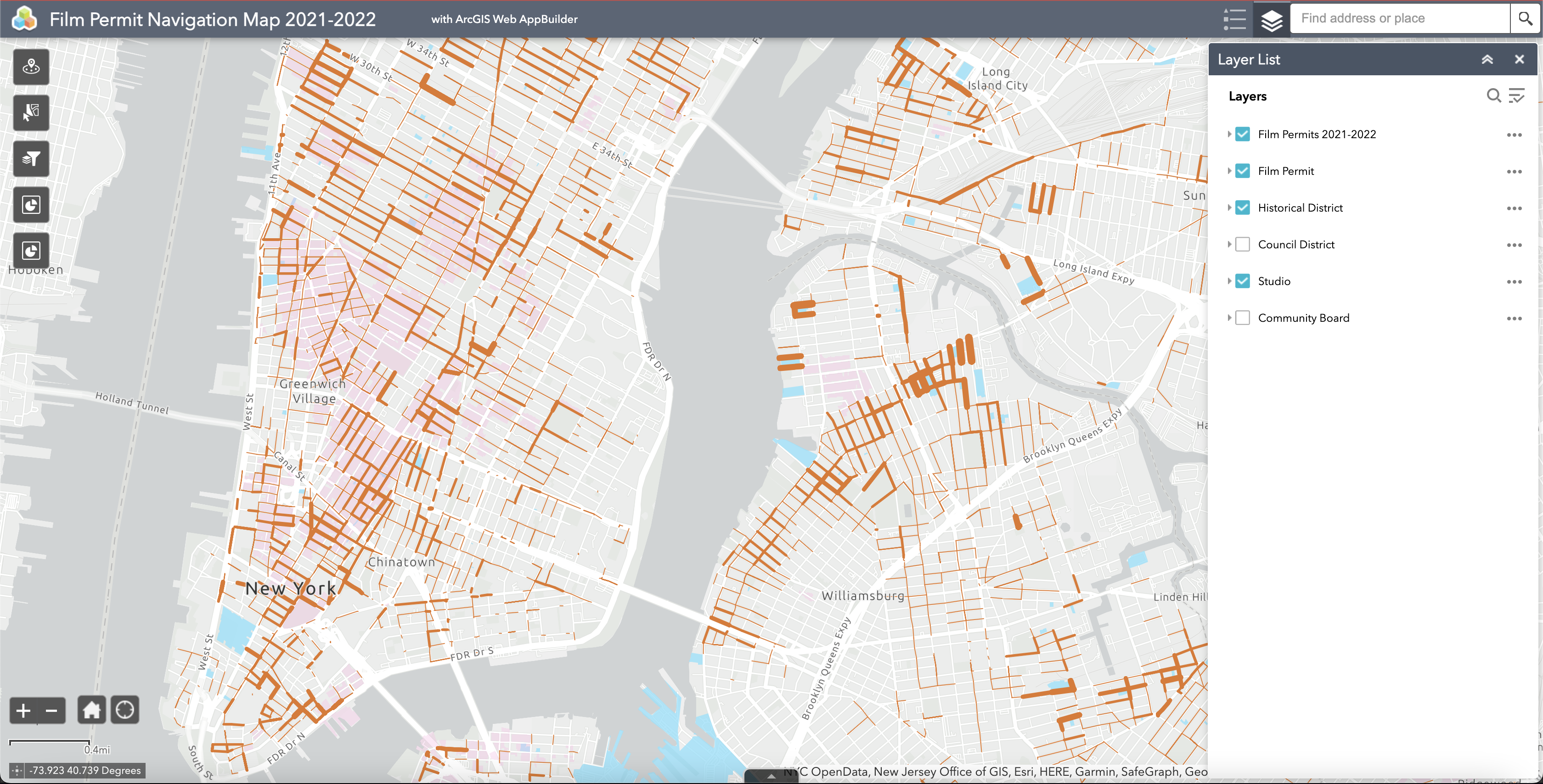
To inform future legislation and community decision-making, we build a digital tool that community members and decision-makers with little technical knowledge or resources could use to easily view and explore the geographies of film permits in NYC neighborhoods over time. Our ultimate intention is that by making the data more accessible, the issue is more actionable for residents and decision-makers. Perhaps it will inspire more thoughtful discussion and democratic solutions in the future.
Detailed information of analysis process, code lines, and digital tools are mentioned in BetaNYC blogpost.

 Map of film permit counts by street segment
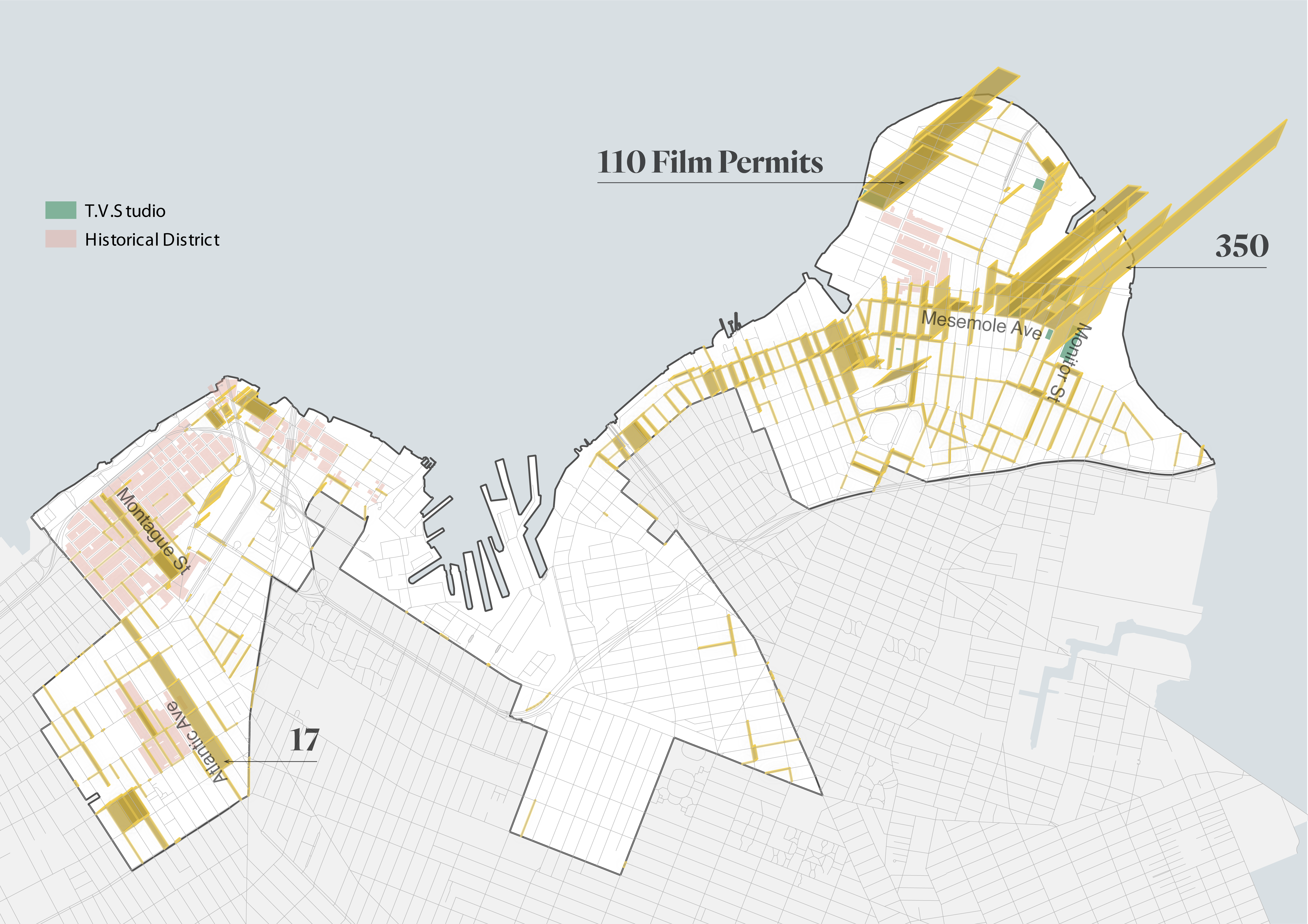
 2.5D Map of film permit counts in Council District 33
 Film permit time duration day sum-ups per census tract, Jan 2021 – March 2022
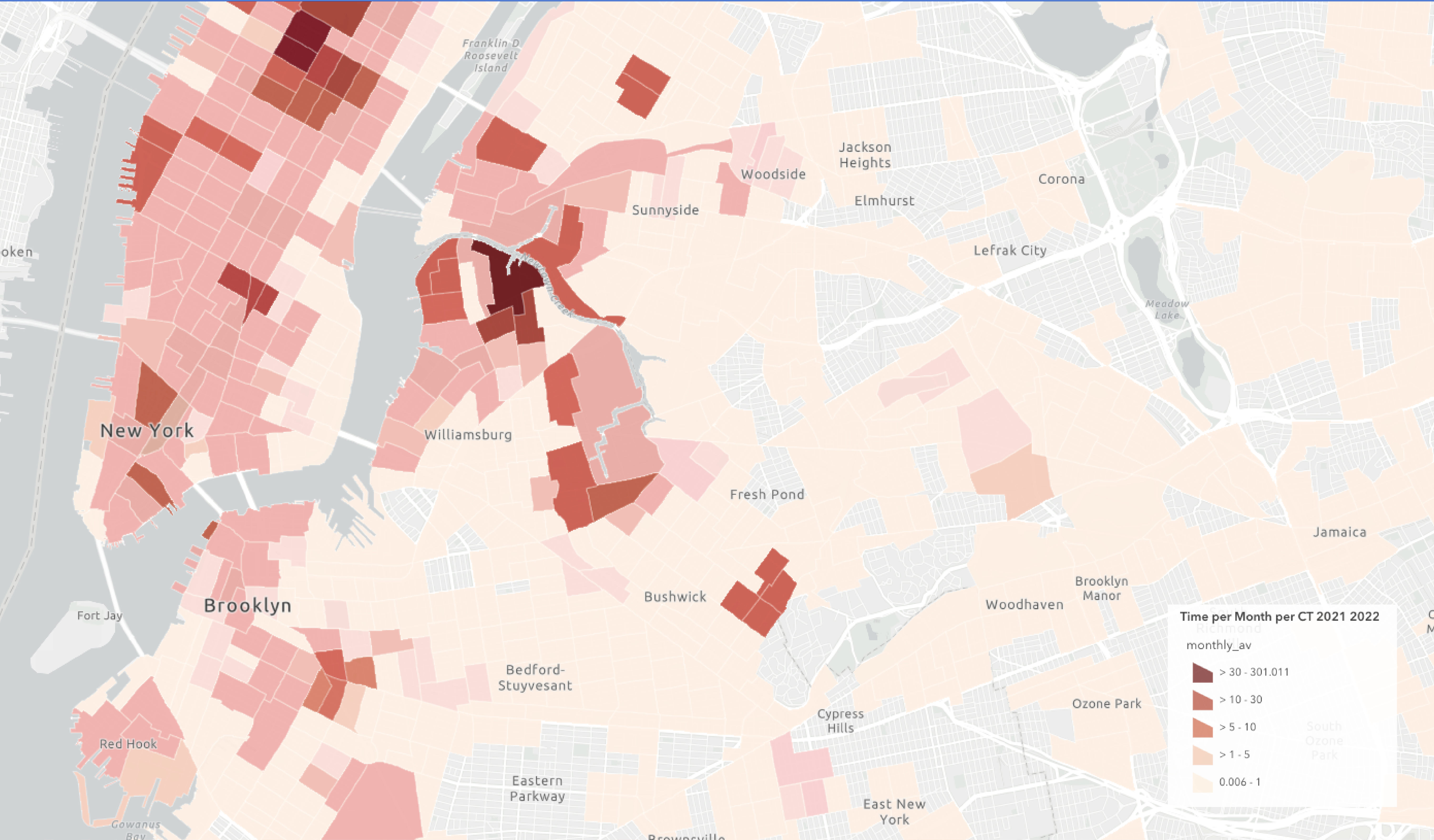 Screenshot of the digital mapping tool